
Col de Marie Blanque
The Col de Marie-Blanque has featured in the Tour de France 14 times, most recently in the 2010 Tour which had a summit finish on the Tourmalet. Whilst it is a fair distance from Argeles Gazost it is a climb well worth making a trip out to do – either driving part of the way by car or for the more adventurous planning a much more challenging and longer riding loop. The route mapped out on this page encompasses the latter option with just under 147kms (91mi) and 3900m (12,802ft) of climbing. It makes for a hard day on the bike taking in no less than 4 summits. Completing this route will no doubt leave you feeling like a champion.
Col de Marie-Blanque
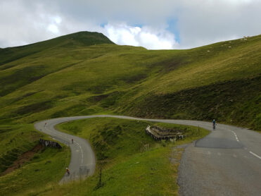
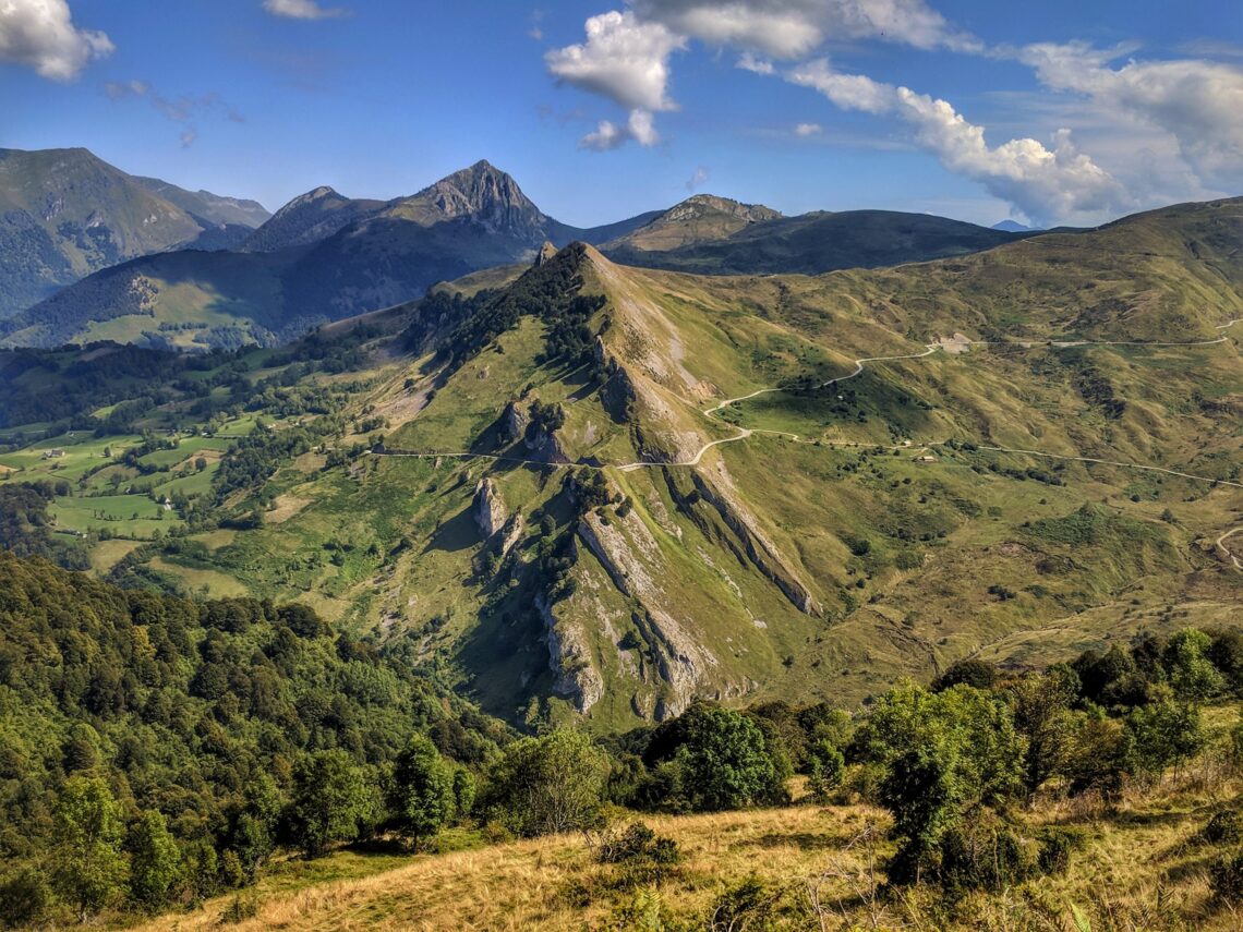
From the starting point at Bielle cycling the Col de Marie Blanque from this approach provides for a longer ascent but with much kinder average gradients. That said, you will encounter the steepest gradients of 8% early on within the first few kilometers of the climb. After the first 3 kilometers though the worst is behind you and the climb continues gently to the summit. As the road winds in and out of the trees, you will start to see the big surrounding mountains come into view. The Plateau de Bénou just a few kilometers shy of the summit itself is a magnificent sight to behold and from here you know the top is not too far away.
Suggested cycling route
Distance: 147km / 91.5mi
Start elevation: 470m / 1,541ft
Max elevation: 1,709m / 5,607ft
Metres climbed: 3,902m / 12,802ft
Metres descended: 3,902m / 12,802ft
Categorised climbs: 4
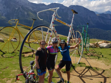
This route takes you back over the Col d’Aubisque and those famous Tour de France big bikes!
Food and water
Food and water are available in numerous villages along this route as well as at the top of the Col du Soulor and the Col d’Aubisque. Given the length of this ride, we recommend you always make sure you have plenty of water and food onboard.
Highlights
* A big day out on the bike with no less than 4 big cols to climb. You will feel like a Tour de France legend.
You will have no shortage of climbing or descending on magic mountain roads on this route.
Climb statistics and gradient profile
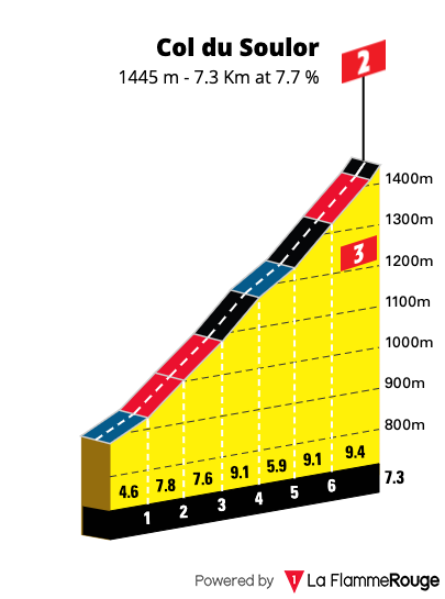
Col du Soulor
Length: 7.5km / 4.66mi
Average gradient: 7.95%
Start point: Arrens Marsous
Elevation at top: 1,474m / 4,836ft
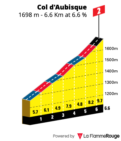
Col d’Aubisque
Length: 10.6km / 6.59mi
Average gradient: 4.6%
Start point: Col du Soulor
Elevation at top: 1,709m / 5,607ft
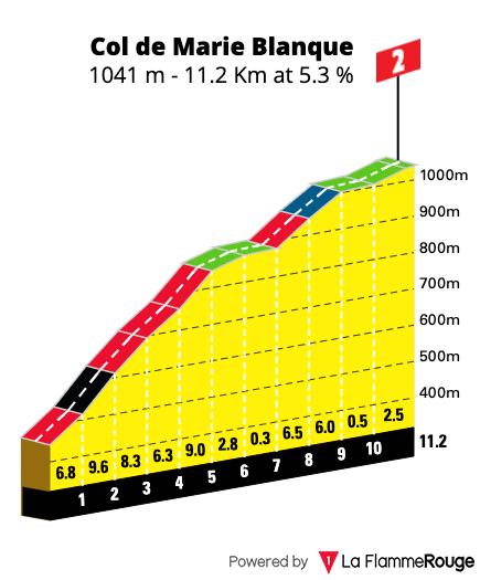
Col de Marie Blanque
Length: 11.2km / 6.96mi
Average gradient: 5.2%
Start point: Bielle
Elevation at top: 1,035m / 3,396
Col du Soulor
Length: 12.1km / 7.52mi
Average gradient: 7.56%
Start point: Ferrières
Elevation at top: 1,474m / 4,836ft

The final climb on this route is the Col du Soulor – one of the most magnificent roads in the Pyrenees.