
A Guide to Cycling – Col des Montets
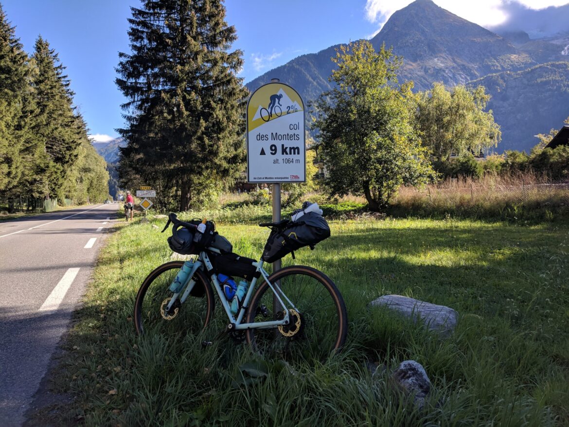
The cycling climb of the Col des Montets is easily accessible when staying in the Chamonix Valley and as such is a favourite amongst road cyclists holidaying in the area. The mountain pass links the valleys of Vallorcine which is on the French/Swiss border with Chamonix and owing to its mild gradients it is a fantastic climb for riders of all fitness levels. Since 1959 the climb has featured in the Tour de France on five occasions and it was last used in the 1977 edition. The Southern approach starts in Chamonix and the average gradient is just under 4% for 11.7kms. You will gain 426m in elevation before reaching the summit at 1461m. At the top of the pass, you will be rewarded with panoramic views of the Mont Blanc mountain range. The small village of Le Châtelard marks the beginning of the climb from the Northern approach. Here the climb is 7.7kms in length, ascending 355m of elevation with an average gradient of 4.8%.
Col des Montets Climb Statistics

Col des Montets Southern Approach
Length: 11.8km / 7.3mi
Average gradient: 3.6%
Start point: 1,037m / 3,402ft
Elevation at top: 1461m / 4,793ft
Category: Category
Nearest town: Chamonix
Facilities at top: Toilets, Picnic Tables
When to ride: March to October
Road condition: Good
Nearest climb: Lac d’Emosson
Number of approaches: 2
Through road at top: Yes

Col des Montets Northern Approach
Length: 7.7km / 4.1mi
Average gradient: 4.8%
Start point: 1,110m / 3,641ft
Elevation at top: 1461m / 4,793ft
Category: Category
Nearest town: Le Châtelard
Facilities at top: Toilets, Picnic Tables
When to ride: March to October
Road condition: Good
Nearest climb: Lac d’Emosson
Number of approaches: 2
Through road at top: Yes
Col des Montets cycling route
Total Ride distance: 40km / 24.8mi
Elevation gain: 857m / 2,812ft
The climb of the Col des Montets is included as part of an out and back cycling route from the centre of Chamonix. Of course, you can easily adjust this to begin from any of the villages along the Chamonix Valley. We have also designed the route so you will ascend both approaches of the climb. If you feel like a shorter ride you can simply return back to Chamonix once you reached the summit of the Col des Montets from the southern approach.
Col des Montets – Southern Approach
As you depart Chamonix you will immediately begin the climb of the Col des Montets. Whilst almost 12kms in length the climb is relatively gentle which means you can get into a good rhythm without having to strain too hard. There are spectacular views along the Chamonix Valley with high peaks and glaciers. A short way into the climb you will pass through an avalanche tunnel which is separated from traffic – yes, cyclists here get their own tunnel! As you make your way up towards the summit you will also see signposts for Mountain bike and hiking trails on either side of the road which gives an indication of the other outdoor pursuits available in this area. Before you know it the summit is in reach. Now you can enjoy the descent all the way down to the French/Swiss border.
Col des Montets – Northern Approach
This side of the mountain pass is the shorter of the two and has a slightly steeper gradient of just under 5% for its 7.7kms. The climb begins in the small village of Le Châtelard. If you need to you can refill your water bottles here before embarking on the ride back to Chamonix. The road surface here is in great condition and given the relatively shallow gradients, you will make good progress to reach the summit once more. Then you have an enjoyable long descent back to where you started the ride in Chamonix. Sure to bring a smile to your face.
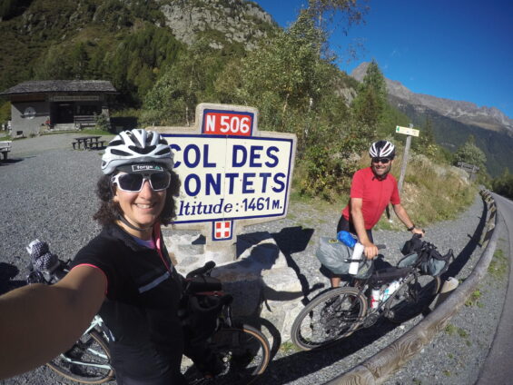
Above: The Summit of the Col des Montets, 1461m.

The view from the summit of the Col des Montets. The high peaks of the Mont Blanc range are clearly visible in the distance.
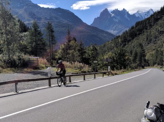
Departing the town of Chamonix, the climb of the Col des Montets begins with a nice gentle gradient.
Cycling Climbs near the Col des Montets
There are a number of other climbs which you could choose to include on this route if you are looking to add on some extra distance and climbing. These are listed below. Click on the ride links to explore the climbs in greater detail.
Col de la Forclaz – Southern Approach
The southern approach of the Col de la Forclaz climb begins at the French/Swiss border in the Trient valley. To include this on your ride you simply keep travelling straight on the road once you have descended the northern approach of the Col des Montets. The Col de la Forclaz climb is 7kms long and has an average gradient of 6.3% In total this climb will add on 15km / 9.3m and 478m, 1,568ft of elevation to your ride.

Cycling in the Chamonix Valley
Unfamiliar with the cycling available in the Chamonix Valley? Check out our comprehensive guide covering everything you need to know to plan your cycling holiday. The guide includes information such as:
- a map of the Chamonix Valley with cycling climbs and towns marked
- where to base yourself for your cycling holiday
- a list of cycling hotels and lodges
- a list of bike hire outlets
- travel information for getting to and from the Chamonix Valley
- non-cycling attractions and activities to discover whilst holidaying in the region