Route des Lacs
The Route de Lacs will take you past four lakes nestled high up in the Pyrenees National Park. Due to their location in a pristine area of the park, the Tour de France is not permitted to hold a stage here. Don’t let this put you off as personally we believe this is one of the best rides you can do in the Pyrenees. Whilst the average gradient on the climb hovers around 8%, you will have long sections which are well into double digits. Allow your surroundings to distract you from the unrelenting steep slopes of the climb.
Suggested cycling route
Distance: 60km / 37.2mi
Start elevation: 816m / 2,677ft
Max elevation: 2,206m / ft
Metres climbed: 1,973m / 6,474ft
Metres descended: 1,973m / 6,474ft
Categorised climbs: 2
Steady climb
From the start, you will leave Saint-Lary Soulon and head towards Fabian a small village only 9km further up the valley. The start of the ride climbs gently, with the road always heading in an upwards direction. This being the case, make sure you save your legs as you will have a lot of climbing ahead of you. Once you reach Fabian turn right and follow the signs for the Route des Lacs. Here you will begin the climb in earnest. The road immediately becomes quite narrow and you just know you are in for a real treat ahead. Outside of the summer months, the road is very quiet and you will have it mainly to yourself.
Alpine forest and cascading waterfalls
This part of the National Park is known for its natural beauty and it is all around you as you continue on the climb. You will be in the thick of an alpine forest but also have great views along the way of cascading waterfalls. The gradient is steep so your surroundings will provide a good distraction as you keep pedaling on ever higher, gaining elevation.
Switchbacks on the climb
Unlike some of the more famous climbs in the Pyrenees, the Route de Lacs does not offer up road signs every km to help you track your progress. There are some other landmarks on the climb through which you can look to ‘tick off’. These come in the form of three sets of switchbacks which are named. The first set is the Lacet des Écureuils. Once past this, you have roughly a further 6kms before you reach the peak at Lac de Cap de Long. Soon after you will pass the Lacet des Myrtilles and then finally, the Lacet des Edelweiss.
Fork in the Road
As Lac d’Oredon begins to come into view, you will reach a point in the road where you can choose to stay straight on, or turn right. The right turn will take you to explore two lakes being the Aubert and Aumar. We recommend doing this on your return and instead, continue straight on to Lac de Cap de Long. As you continue on climbing the scenery somehow keeps getting more spectacular.
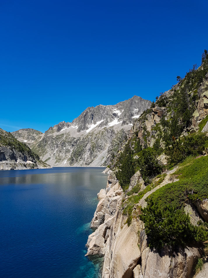
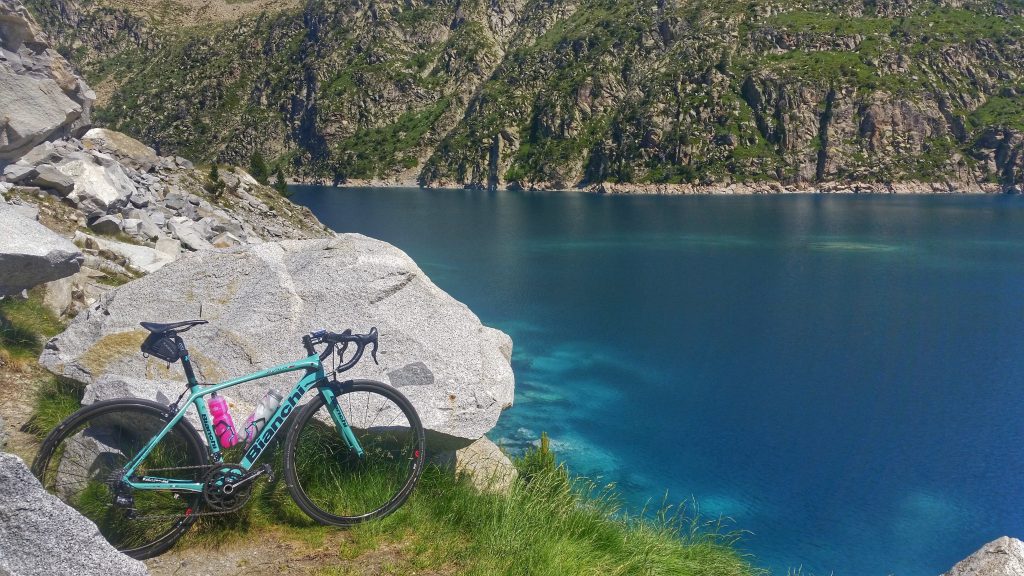
Lac de Cap de Long
A few kilometers from the top your legs are given a slight reprieve with a downhill section. This is quickly followed by a stunning set of switchbacks that lead you closer to the top. This section of road is often over 10% in gradient and the views as you keep on climbing are simply out of this word. If you don’t stop here on the way up, be sure to do so on the way back down so you can really appreciate the landscape around you.
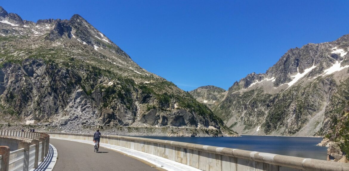
Once past the switchbacks, the top of the climb is upon you. The end of the road will take you across the dam wall of Lac de Cap de Long. This is the largest water reservoir in the Pyrenees and makes for a stunning sight. In the summer months, there is a cafe at the top from where you can replenish food and water supplies.
Lac d’Aumar and Lac d’Aubert
On the way back, taking the turn off on the road will take you past Lac d’Oredon. From there the road climbs very steeply onwards with gradients hovering around 15 in some sections. It is well worth the short 5.5km climb to add on to your ride though – after all, it isn’t often you get to ride past 4 lakes in one day! Both the Aumar and Aubert offer up stunning views of pristine lakes surrounded by the high peaks of this part of the Pyrenean Massif.
Lac d’Aumar is the highest elevation point on the ride topping out at 2192m in elevation – higher than the Tourmalet! Once you have taken in the scenery you can finally look to enjoy the long descent back to your starting point. Be mindful the road is rough which makes for a more technical descent.

Food and water
We recommend you stock up with food and water in Saint-Laury Soulon at the start of this route.
There is also a cafe at the summit of Cap de Lac de Long where you can top up your supplies.
Highlights
- Seeing no less than 4 lakes over the course of 1 ride.
- The view from the final set of switchbacks on Lac de Cap de Long are out of this world.
- Hearing and seeing the waterfalls cascading down the mountains.
Climb statistics and gradient profile

Lac de Cap de Long
Length: 23.1km / 14.35mi
Average gradient: 5.9%
Start point: Saint Lary Soulan
Elevation at top: 2,172m / 7,126ft
Lac d’Aubert
Length: 5.5km / 3.42mi
Average gradient: 6.56%
Start point: Refuge d’Orédon
Elevation at top: 2210m / 7,251